10 Trails to Visit This Summer
By: Hank Shell
Here are a few of our favorite trails to visit this summer:
1) Titcomb Basin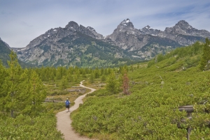
Location: Pinedale, WY
Distance: 27.9 miles
Difficulty: Strenuous
Approaching Wyoming’s Wind River Range from the south is my favorite route of arrival. The range rises without warning from the state’s flat expanse of high southern plains, a welcome incongruity from the otherwise monotonous landscape.
Technically part of the of the Rocky Mountains, the Wind River Range is a truly sublime land of soaring granite towers, crystal clear lakes and rivers, and endless sporting opportunities.
Titcomb Basin is located in the northern part of the range, and offers world class fishing, hiking and climbing for those willing to seek it out. Approach the basin from the Elkhart Park trailhead in Pinedale. Grizzly and black bear are present in the range. A bear-proof canister is recommended for food items.
2) John Muir Trail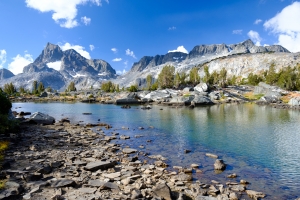
Location: Yosemite Valley, CA
Distance: 211 miles
Difficulty: Strenuous
Named after the famed Scottish American naturalist, the John Muir Trail follows a section of the Pacific Crest Trail through Colorado’s Sierra Nevada Range.
Most hikers make the journey from north to south, starting at Happy Isles in Yosemite Valley and finishing at the summit of 14,505-foot Mount Whitney. The trail offers a tour of the some of the High Sierra’s most dramatic landscapes and passes through Yosemite, Kings Canyon and Sequoia national parks. While an especially long and grueling route, hikers will be rewarded with relative solitude and unsurpassed vistas of California’s high country.
Gear Suggestion: Salomon Quest 4D 2 GTX
Related Article: Best New Fly Fishing Gear of 2017
3) Profile Trail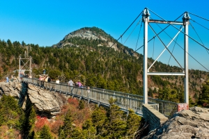
Location: Boone, NC
Distance: 7 miles
Difficulty: Moderate
Located along North Carolina’s Blue Ridge, this trail takes visitors to the top of Grandfather Mountain. Starting in a low mountain valley, the trail ascends through thickets of rhododendron and mountain laurel, gigantic boulder gardens and over crystal clear mountain streams to gain the summit of the 5,945-foot peak.
The famed Scottish American naturalist John Muir once called Grandfather “the face of all Heaven come to earth.” A plaque bearing some of Muir’s thoughts on the locale still sits along this trail. From the summit, it’s easy to see what he meant. To the west, the rippling high country of Appalachia flows to the horizon.
To the east and on especially clear days, visitors to the summit can see the skyline of Charlotte, nearly 100 miles away.
4) Blue Lakes Trail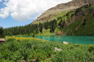
Location: Ridgway, CO
Distance: 13.3 miles
Difficulty: Strenuous
Colorado’s southern San Juan Range is lauded as a winter playground for skiers and snowboarders, but locals anticipate the summers here with equal excitement.
The Blue Lakes Trail is perhaps the most popular backcountry trail in this range, sweeping hikers up into the rugged Mt. Sneffels Wilderness. With almost 4,000 feet of elevation gain, it’s no walk in the park, but expect to be rewarded with views of red painted mountainsides, pristine turquoise lakes and saw-toothed skylines.
The trail is generally inaccessible until well into summer.
Gear Suggestion: Osprey Packs Osprey Stratos 36 Backpack
5) High Divide Loop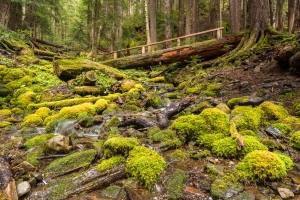
Location: Olympic National Park, WA
Distance: 17.6 miles
Difficulty: Strenuous
Washington’s Olympic National Park is a place of remarkably diverse landscapes. From rainforests to alpine meadows, there’s no better way to see them all than on the High Divide Loop.
The trail ascends almost 4,000 feet as it rambles around the rim of Seven Lakes Basin with views of Mount Olympus, elevation 7,979 feet. Allow for around 10 hours to complete the full loop. Weather in the alpine can be fickle, and it’s good to pack for variable conditions, regardless of what the weather report says
Related Article: Get Outside and Exercise – Your Immune System Will Thank You
6) Chapel Loop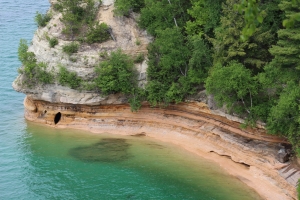
Location: Michigan
Distance: 10.4 miles
Difficulty: Easy
While the Midwest isn’t typically renowned for its hiking opportunities, Michigan’s Chapel Loop is one exception. This loop trail, located along Pictured Rocks National Lakeshore, treats hikers to some of Lake Superior’s most remarkable shoreline. Namely, dramatic sandstone bluffs that fall away into the lake.
Start off meandering through the lakeside forest where you’ll pass a couple of waterfalls. The trail eventually meets the lakeshore, following the cliffs for more than four miles.
Waterfalls also tumble from the cliff into the lake, providing a truly unique landscape. The lakeshore is open year-round, and the loop can be hiked any time of year.
7) Marcy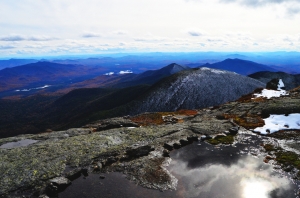
Location: Lake Placid, New York
Distance: 14 miles one way
Difficulty: Moderate
This route ascends Mt. Marcy, New York’s highest point, and is one of the most popular hikes in the Adirondacks. With 3,000 feet of elevation gain in 14 miles, it’s not especially grueling, though it does require some stamina.
The route follows the Van Hoevenberg Trail to Mt. Marcy Dam before ascending up into the high country. Expect this section of trail to be heavily trafficked, as it is an arterial connection to other peaks and trails in the area.
From the dam, follow the signs to Mt. Marcy and enjoy the views of waterfalls and mountain lakes along the way.
Gear Suggestion: Black Diamond Alpine Carbon Cork Trekking Poles
8) Crater Lake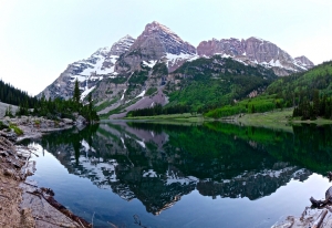
Location: Grand Lake, CO
Distance: 14.8 miles round trip.
Difficulty: Moderate
Our other featured hike in Colorado, this trail in Indian Peaks Wilderness takes hikers to some of the most remote and rugged terrain in the state. Starting along the east side of Lake Granby near Grand Lake, runs briefly along the shore of Monarch Lake before ascending up into the mountains.
In spring and summer, the valley floor will be carpeted with Lupine, Mountain Gentian, Columbine and other wild flowers.
Continue all the way to Crater Lake for commanding views of Lone Eagle Peak, which towers imposingly over the lake.
It’s a good idea to get an early start on this trail, as late afternoon thunderstorms are like clockwork in this part of Colorado during the summer.
9) The Narrows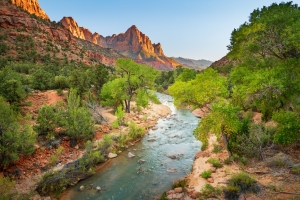
Location: Zion National Park, Utah
Distance: 16 miles
Difficulty: Moderate
One of the most unique trails on our list, the Narrows Trail descends the narrowest part of Zion Canyon. Expect to get your feet wet, as this trail meanders along, and through, the Virgin River.
The best way to hike the trail is from above, starting at Chamberlain’s Ranch. A permit is required for this route. From Chamberlain, the route is pretty simple – just follow the canyon down.
There are 12 marked campsites along this route, and I highly recommend spending a night in the canyon.
Keep a close eye on the weather. Flash floods in a slot canyon can be very deadly. Spring and summer are the best times of year to complete this hike.
Related Article: A Weekend in Colorado’s San Juan Backcountry
10) Rim Trail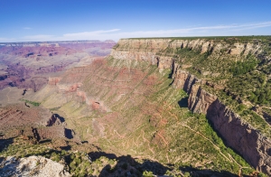
Location: Grand Canyon, Arizona
Distance. 13.1 miles
Difficulty: Easy
While most of this trail is paved and as such not technically a “hiking” trail, the views of the Grand Canyon’s gaping abyss make it one you shouldn’t miss.
With little elevation gain, the trail is very mellow and allows visitors to truly take it all in.
Starting at Hermit’s Rest, the path winds along the rim to the South Kaibab trailhead. Though it is a pretty tame trail, don’t forget to bring water. If you can, try to view the sunset from Hopi Point, one of the stops along the trail.
(adsbygoogle = window.adsbygoogle || []).push({});
You Might Like:
Increase the Intensity with HyperWear’s Vest Pro
Hank Shell Spring has arrived here in the beautiful San Juan Mountains. Those slate gray and gelid winter mornings are giving way, albeit reluctantly, to temperate sunrises and birdsong. Each day the rivers grow with...Muse: A heart rate monitor for your head
A Review by Hank Shell I’m all about mindfulness, y’all. If you’ve read my columns, you know this. If you haven’t, then that’s your misfortune. Anyway, mindfulness can have all kinds of wonderful health benefits,...Motiv Ring: The Next Best Innovative Fitness Tracker
Hank Shell There’s a piece of your workout kit that’s missing. Can you guess what it is? I’ll give you a hint – it’s not a steezy headband … or a shake weight. C’mon, dude....Pedaling Innovations: High-Performing & Comfortable Clipless Pedals
Hank Shell Everyone remembers the first time they ate it on a set of clip in pedals. I remember my first time like it was yesterday. It was crisp November morning at the RAT near...HIIT Hill Workouts For Runners
Hank Shell So, it’s winter time. And don’t get me wrong – I LOVE winter. I like skiing, throwing ice at passing cars and, more recently, climbing ice – see Cold ~ Hard ~ Ice...Cold ~ Hard ~ Ice Climbing in the San Juans
Hank Shell The sound of tearing fabric reached my ear, as it always does, with the delicacy of a lover’s whisper. It was an unintelligible anomaly, mired as it was in the din of the...(adsbygoogle = window.adsbygoogle || []).push({});


